AI satellite monitoring of ground assets
Pipelines, mines, licence blocks, water bodies. Nadir AI watches remote sites and industrial territories and detects changes before they become incidents.
Large territories cannot be inspected by hand
Patrols, helicopter flyovers and one-off inspections give a fragmented picture. Between two checks, illegal activity, a spill, a new structure, excavation or erosion appears unnoticed.
per hour, ~100–150 km of coverage
per month or less on remote sites
fines, clean-up, reputation
annual industry losses across the CIS
With a monthly inspection, a risk lives unobserved for 29 days.
You choose the zone. We watch for change
One pipeline under the hood: scheduled satellite imagery, AI change analysis, alerts into your channels. From a satellite frame to a management decision.
Define the zone
Mark the territory on the map: a polygon, a corridor, a site, a field or an infrastructure area.
Imagery
The service selects imagery by cadence, resolution, weather and the monitoring task.
AI analysis
The model compares new imagery with the baseline and looks for deviations and signs of anomalies.
Alert
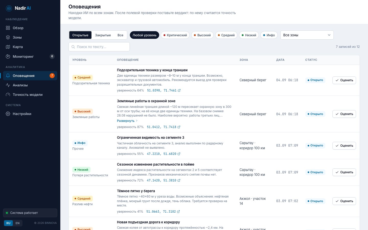
On a significant change you receive a notification with coordinates, a before/after view and a risk description.
Decision
A field crew verifies the site; the company gets an evidence base for reporting.
One service. Five applications
Only the target changes. From spills along a pipeline to illegal mining on a licence block the size of a province.
Corridors and right-of-way
Pipelines and remote assets without flyovers: spills, illegal taps, excavation, encroachment in the right-of-way.
Pits, dumps, tailings
Work boundaries, waste accumulation, water bodies, dust, reclamation, ESG risks.
Licence blocks
Illegal mining, new machinery, new roads and structures inside the licence territory.
Fields and land assets
Vegetation, soil degradation, flooding, drought, machinery tracks, boundary violations.
Land and construction sites
Land condition before, during and after construction: unauthorised builds, terrain, access roads.
What the model looks for
Oil spill, unauthorised construction, suspicious vehicles, vegetation loss, excavation, erosion and landslides, smoke and fire, illegal mining, water pollution.
The whole picture in 30 seconds
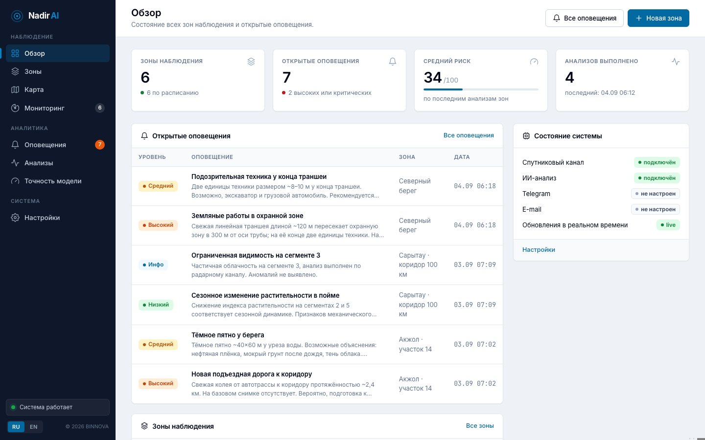
The duty operator opens the dashboard and immediately sees what is calm, where a crew is needed and exactly where. Runs in the browser, nothing to install, interface in Russian and English.
Before / after analysis
A large zone is automatically sliced into ~20 km segments along the route: each is captured at native resolution instead of being squeezed into one frame. The AI compares the baseline and current scenes, returns coordinates and alternative explanations for every finding.
- Optical and radar
Optical imagery by day, radar through clouds and at night. Under cloud the service switches to the radar channel on its own.
- Calibrated confidence
The model does not invent findings on empty scenes and states probability and alternatives for each one.
- Precision is measured on your data
The operator confirms or rejects every alert; model precision by category is shown on a dedicated page.
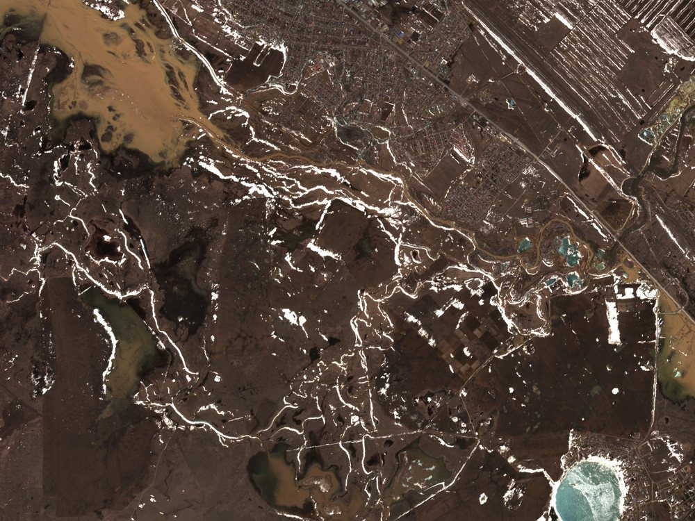
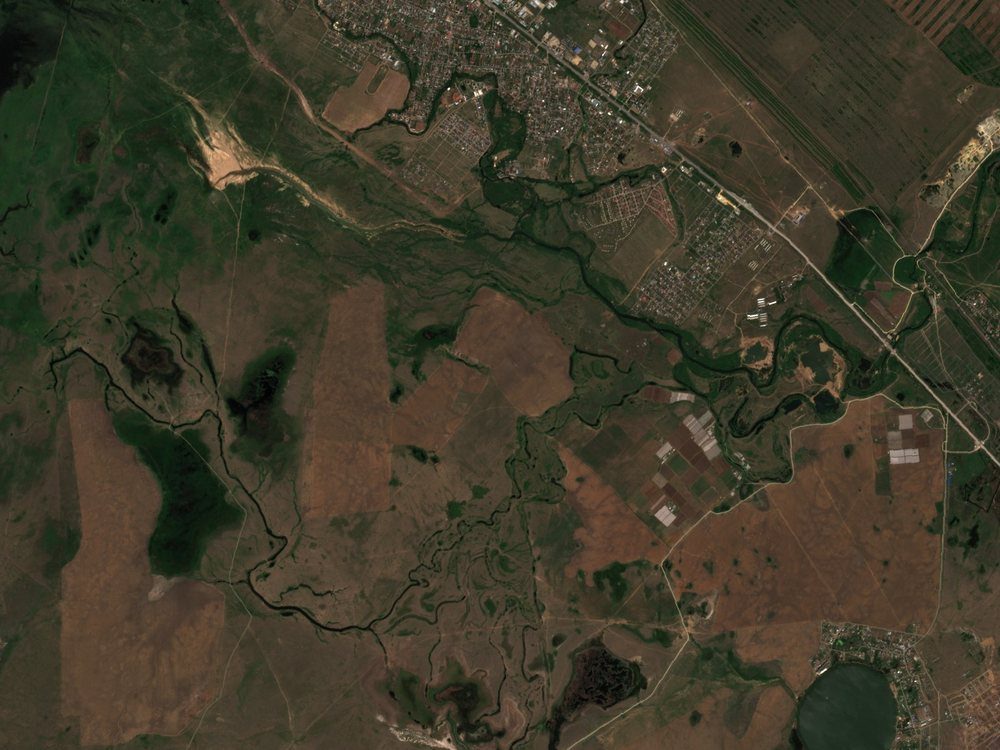
A fresh linear trench ~120 m long crosses the right-of-way 300 m from the pipeline axis, with two vehicles at its end. Most likely: third-party works. Alternatives: drainage, seismic survey line.
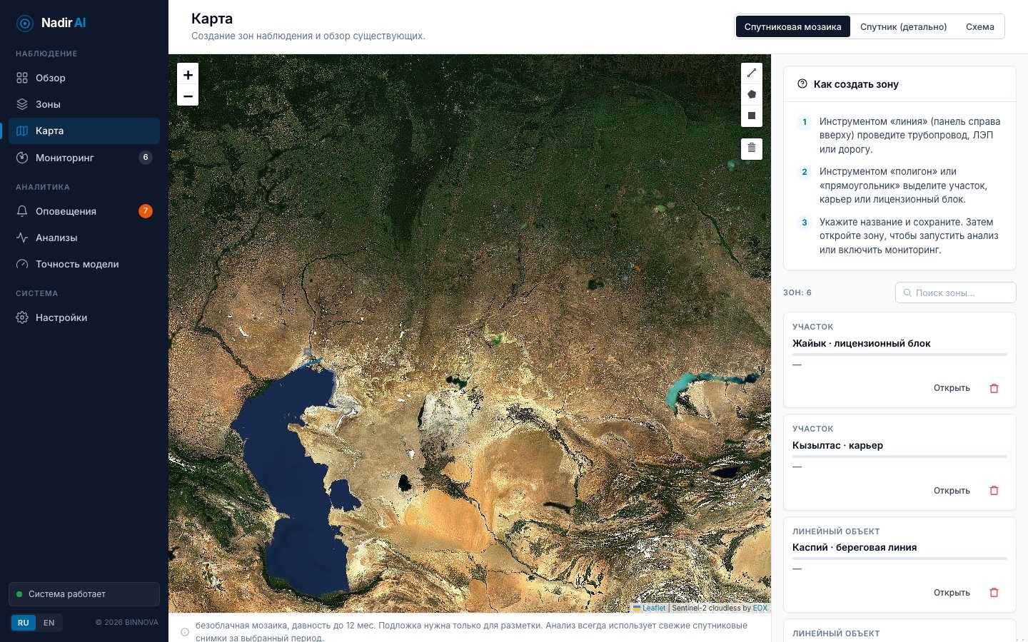
Draw the zone. The rest is automatic
A pipeline is traced as a line, a licence block or a site as a polygon. The service adds a buffer, slices long corridors into segments and starts watching. One map shows every zone with its risk level, open alerts and next capture.
buffer from 100 to 3,000 m
up to ~320 km of corridor in one zone
daily, every three days or weekly
Alerts where your team already works
Email, Telegram, web dashboard, webhook into SCADA or ITSM. Every alert comes with before and after images, coordinates and time: a ready evidence base for incident review and management reporting.
What is inside the service
A mature pipeline: from image selection to a calibrated alert. Minimal new processes on the customer side, maximum reduction of blind spots.
Satellite data
Optical imagery by day, radar through clouds and at night. A cloud-free mosaic as the basemap, a fresh scene for every analysis period.
AI image analysis
Before/after comparison across 9 categories. Multi-hypothesis interpretation: the model calibrates its confidence and does not invent findings on empty scenes.
Autonomy
Scheduled autonomous runs, corridor tiling into segments, de-duplication, automatic switch to radar under cloud.
Alerts and accuracy
Email, Telegram, web dashboard, webhook into SCADA. Operator verdict → automatic model-precision metrics. On-premises for closed networks.
A subscription instead of flyovers
Satellite infrastructure monitoring already replaces flyovers for operators in the US and Europe. In Kazakhstan and its neighbours no product of this class exists. The customer pays for the area under observation and the capture frequency and gets the result, not imagery.
Subscription per area
Per kilometre of corridor or km² of area, multiplied by capture frequency: daily, every three days or weekly.
Three tiers
Base: scheduled optical. Plus: all-weather radar. Premium: triggered high-resolution tasking and an on-premises licence.
10× cheaper than flyovers
A helicopter hour costs $3–5k for ~100–150 km. Scheduled monitoring of the same route is an order of magnitude cheaper and never skips weeks between checks.
A local product
Russian and Kazakh interface, on-premises for closed networks, domestic imagery, a price an order of magnitude below European offerings.
They pay for peace of mind between inspections, not for imagery.
A pilot in 8 weeks
One site, real data, a measurable result. No integrations and no load on your teams.
Site
You choose one to three assets: a corridor up to 300 km or a block up to 5,000 km².
Backtest
We run the last 12 months of imagery: what could have been spotted earlier.
Live monitoring
Six weeks on a schedule. Alerts to your team's email and messenger.
Verification
Your specialists record verdicts on findings; we measure precision on your site.
Report
Event summary, precision, economics versus flyovers and a subscription proposal.
Where the project is going
From a working product to an industrial service with a trainable model and a proprietary labelled dataset of the Kazakh landscape.
- 2025
Concept and prototype. Service architecture, satellite pipeline, first AI analysis of imagery for a chosen zone.
- 2026
Working product. Scheduled monitoring, corridor tiling, radar, accuracy loop, alert channels. Pilots on real customer data.
- 2027
Scale and model. Training our own model on operator verdicts, on-premises delivery, expansion to Uzbekistan and Mongolia.
- Next
High resolution. Triggered tasking of high-resolution imagery, integration with drones and SCADA.
The first consultation and estimate are free
Leave a request. Within one business day you will hear from the head of the relevant practice, not a scripted sales rep.
Mon–Fri, 9:00–18:00. Meetings online or at your office.